| |
|||
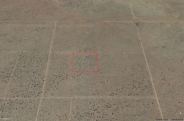
| 2.55
Acres SE of California City |
|||
|
|
 |
||
 |
|||
 |
|||
 |
|||
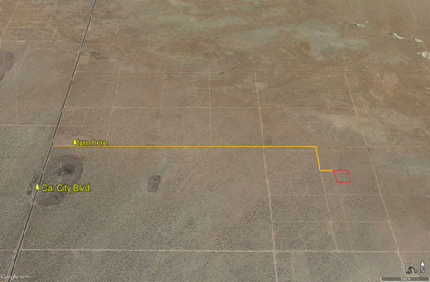
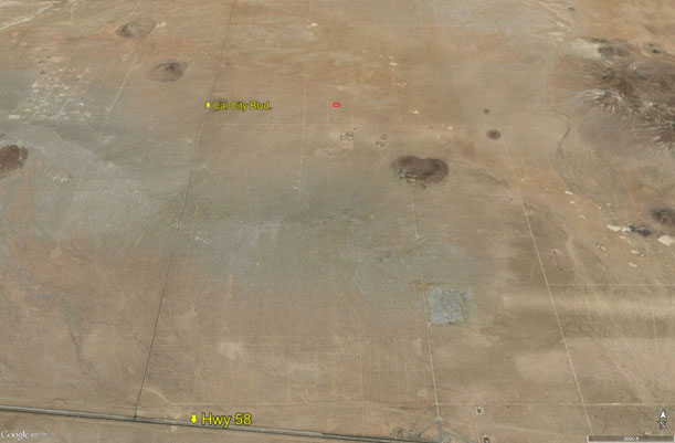
| Location- |
north of Hwy 58; east of California City Blvd | |
Area- |
California City | |
Acres- |
2.55 net acres | |
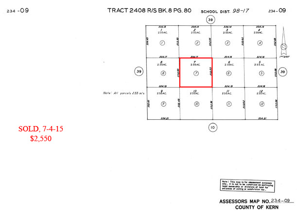
APN- |
234- 090- 07 | |
Zoning- |
Miscellaneous Vacant Land; residential use OK | |
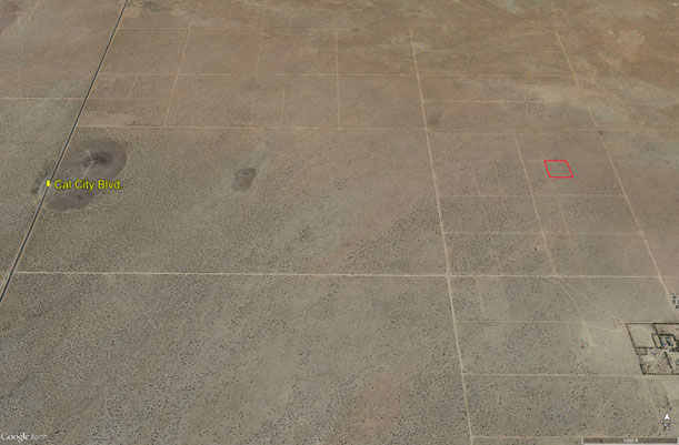
Topography- |
flat & level | |
Dimensions- |
332’ x 334’ | |
Utilities- |
none to parcel | |
Pricing- |
$2,550 ($1,000 per acre) | |
Existing Notes- |
free and clear | |
Terms- |
all cash | |
Remarks- |
Located 3.65
miles north of Hwy 58 and 1.35 miles east of California City Blvd. Flat
and level. Pass-able dirt roads lead to parcel. No utilities to parcel.
|
|
Safety and Cautions- |
Anyone inspecting, or walking on the property, off the road, should be aware that rattlesnakes and other desert wild life could be in the area. Be careful and use common sense! | |
Directions to Property- |
North on Hwy 14 to Mojave. Once at Mojave, go east on Hwy 58 for 16 miles to California City Blvd. Turn left (north) on California City Blvd and go 3.65 miles to the dirt road indicated above. Turn right (east) on this dirt road and go 1.25 miles. Stop. Turn right (south) at the dirt road and go approx. 1/10 of a mile to the next dirt road. At the next dirt road, turn left (west) and go 330 feet. Stop. You are now at the NW corner of property in question. |
|