| |
|||
| 20
Acres, 121st St East & Ave T-14, Pearblossom |
|||
|
|
 |
||
 |
|||
 |
|||
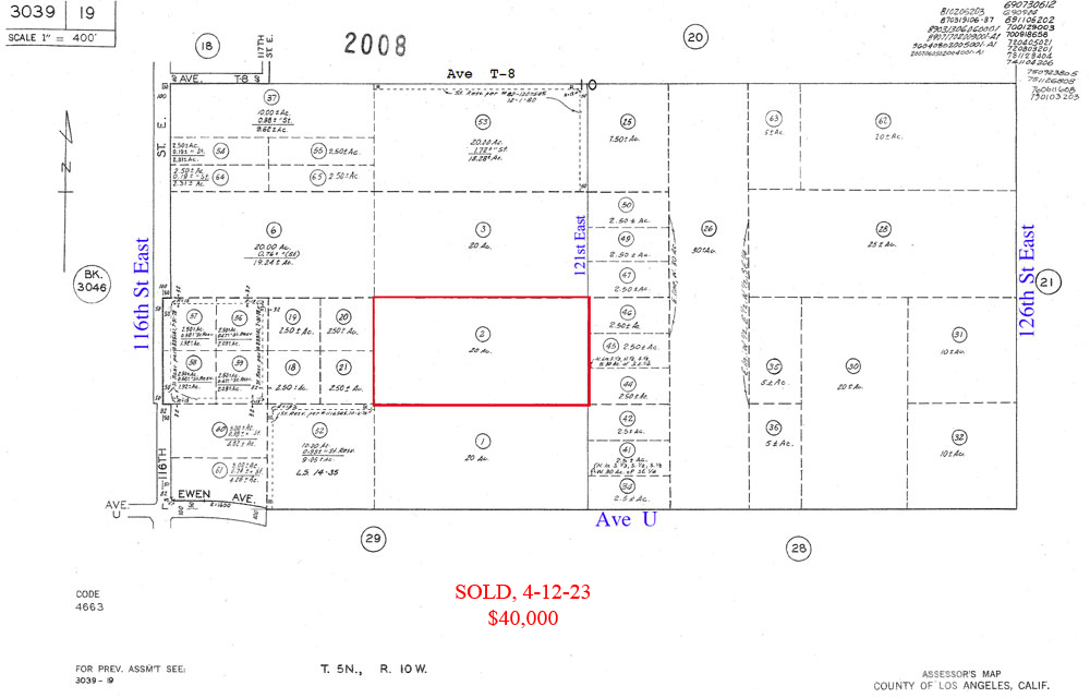
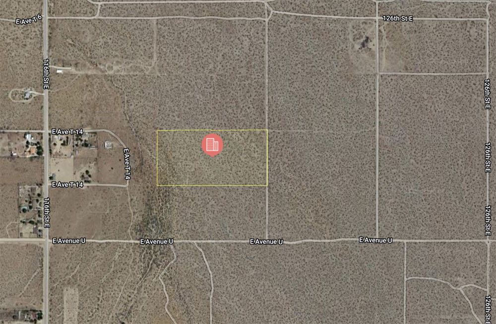
| Location- |
121st St East & Ave T-14 | |
Area- |
Pearblossom, east of Palmdale | |
Acres- |
20 |
|
APN- |
3039- 019- 002 |
|
Zoning- |
A 2 2 (heavy agri) R L 10 | |
Topography- |
flat & level | |
Dimensions- |
660’ x 1,320’ | |
Utilities- |
none to parcel, (elec 700 ft to west) | |
Price- |
$54,000 ($2,700 per/acre) | |
Existing Notes- |
free & clear | |
Terms- |
all cash | |
Remarks- |
Investor path of growth parcel in the Pearblossom area.
Pearblossom is a rural bedroom community, just 7 miles east of Palmdale.
Present zoning is A 2 2, R L 10; heavy agriculture, Rural Land, one
home per ten acres. Nearest elec line appears to be 700 feet to the
west on Ave T-14. In addition, zoning of A 2 2 allows for commercial
solar farm use. North to south, parcel runs from Ave T-12 to Ave T-14.
In general, the boundaries for the Pearblossom community are: 121st
St East on the west, Ave U on the north, 146th St East on the east,
and Ave X-15 on the south. Affordable land banking opportunity that
is near housing.
Highest
& Best use: ranch, farm, land banking |
|
Safety and Cautions- |
Anyone inspecting, or walking on the property, off the road, should be aware that rattlesnakes and other desert wild life could be in the area. Be careful and use common sense! | |
Directions to Property- |
From
the Fwy 14, take the Pearblossom exit going east. Go 5.5 + miles to
4 Points, a major signalized intersection. Go straight ahead; this street
now becomes Ave T. Continue east on Ave T to 116th St East. Turn right
(S) on 116th East and go 1 mile to Ave U (dirt). USE ODOMETER now: turn
left (E) on Ave U and go 1/2 mile to 121st East (no sign), a dirt road.
Subject property is 660 feet north and will be on your left. No sign
on parcel. |
|
|