| |
|||
|
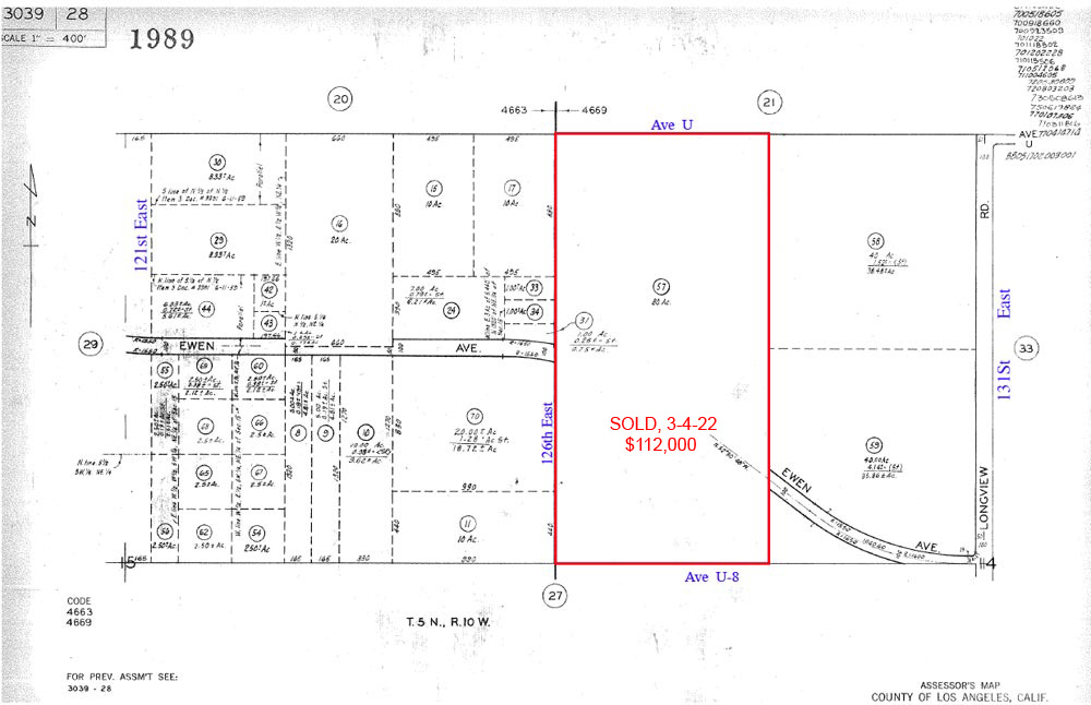
80 Acres, 126th St East & Ave U |
|||
|
|
 |
||
 |
|||
 |
|||
 |
|||
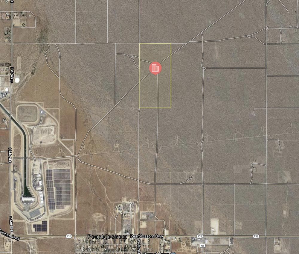
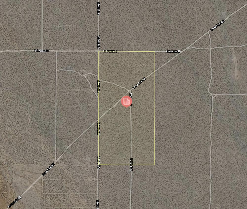
| Location- |
126th St East & Ave U (parcel extends south to Ave U-8) | |
Area- |
Pearblossom, east of Palmdale | |
Acres- |
80 net acres |
|
APN- |
3039- 028- 057 |
|
Zoning- |
A 2 2 (heavy agri) R L 10 | |
Topography- |
flat & level | |
Dimensions- |
1320’ x 2,640’ | |
Utilities- |
none to property, see remarks | |
Price- |
$112,000 ($1,400 per acre) | |
Existing Notes- |
free & clear | |
Terms- |
all cash | |
Remarks- |
Investor path of growth
parcel in the Pearblossom area. Pearblossom is a rural bedroom community,
just 7 miles east of Palmdale. Present zoning is A 2 2, R L 10; heavy
agriculture, Rural Land, one home per ten acres. Nearest elec line is
1 mile to the west on 116th St East, or 1 mile to the south on Pearblossom
Hwy. Highest
& Best use: ranch, farm homesite / land bank |
|
Safety and Cautions- |
Anyone inspecting, or walking on the property, off the road, should be aware that rattlesnakes and other desert wild life could be in the area. Be careful and use common sense! | |
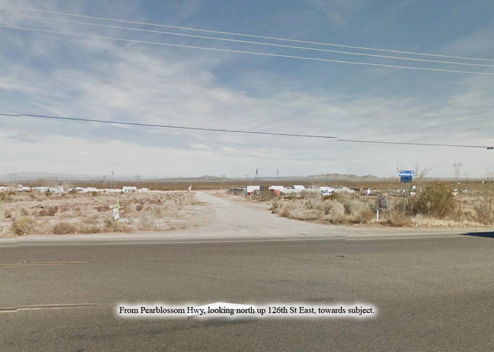
Directions to Property- |
From
the Fwy 14, take the Pearblossom exit going east. Go 5.5 + miles to
4 Points, a major signalized intersection. Turn right (SE) on Pearblossom
Hwy (Hwy 138). Go through Littlerock and continue east on Hwy 138. Once
you enter Pearblossom, at 126th St East, turn left (N). 126th East is
a dirt road and has a street sign. Proceed north for 1 mile. Stop.
Your are now at the SW corner of subject property.. |
|