| |
|||
|
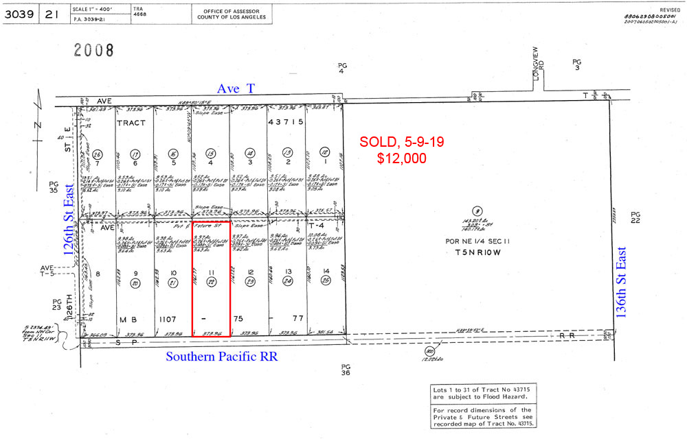
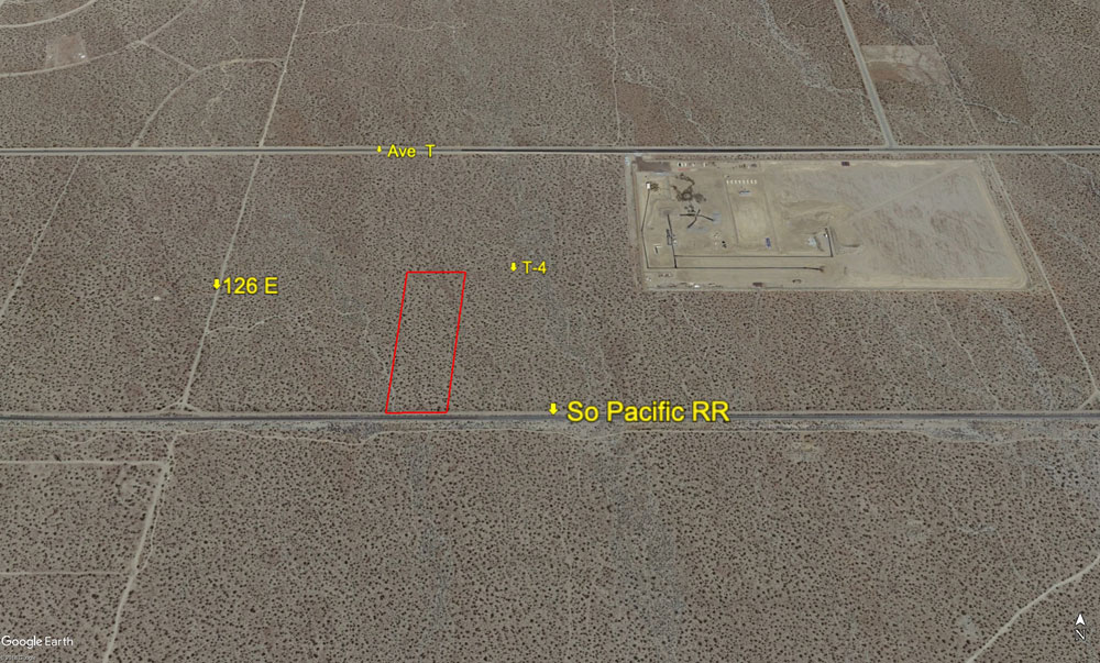
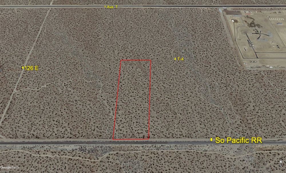
9.63 Acres, 128E & T-4, Fronts Southern Pacific Railroad |
|||
|
|
 |
||
 |
|||
 |
|||
| Location- |
128th St East at Ave T-4 | |
Area- |
Pearblossom, SE of Palmdale | |
Acres- |
9.63 net |
|
APN- |
3039-21- 22 |
|
Zoning- |
A 2 2, RL 10 | |
Topography- |
flat and level | |
Dimensions- |
374’ X 1,121' | |
Utilities- |
none to parcel | |
Price- |
$14,000 ($1,454 per/acre) | |
Existing Notes- |
free & clear | |
Terms- |
all cash | |
Remarks- |
Investor path
of growth parcel in the Pearblossom area, which fronts Ave T-4 on the
north and the Southern Pacific RR on the south. Frontage on the RR tracks
is 374 feet. Zoning as it is now allows for heavy agricultural use and
1 residence. Parcel was legally created by tract map 43715. No utilities
to property at this time. A group of homes is located on 116th East,
1.5 miles due west. |
|
Safety and Cautions- |
Anyone inspecting, or walking on the property, off the road, should be aware that rattlesnakes and other desert wild life could be in the area. Be careful and use common sense! | |
Directions to Property- |
Go
east on Palmdale Blvd to 90th St East. Turn right (S) on 90E and go
2.5 miles to Ave T. Turn left (E) on Ave T and go 3.6 miles to 126th
St East (dirt road). Turn right (S) on 126E and go to the railroad tracks.
From the RR tracks, go left (E) on dirt road along RR tracks for 2/10
of a mile. Stop. You are
now at the SW corner of subject property. |
|