| |
|||
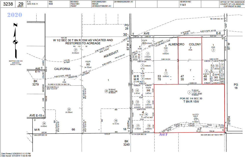
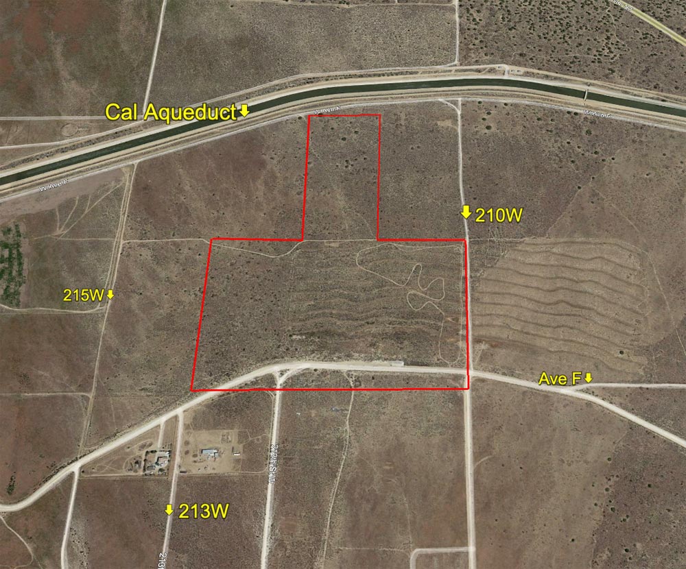
| 72.66Acres
@ 210th West & Cal Aqueduct |
|||
|
|
 |
||
 |
|||
| Location- |
@ 210th St West & Ave F, NW corner | |
Area- |
NW of Lancaster | |
Acres- |
77.66 net acres |
|
APN- |
3238- 029- 001 |
|
Zoning- |
A 2, R L 10 | |
Topography- |
level and flat | |
Dimensions- |
1,980 ft. x 2,640 ft (irregular) | |
Utilities- |
elec power line at 212W & F-2. | |
Price- |
$108,999 ($1,500 p/acre) | |
Existing Notes- |
free & clear | |
Terms- |
all cash | |
Remarks- |
Affordable rural acreage up against the Cal Aqueduct on the north
(Ave E-8), extending south 1/2 mile to Ave F. Zoning of A 2, R L 10
equates to heavy agriculture, one home per 10 acres. With the new
county regulation allowing Alternative Dwelling Units (ADU), an additional
home would be allowed. Elec power is on 212th West, just 1/4 mile
due south which services a nearby home. Homes in this area are on
well water and septic systems. Parcel can be driven to, scroll down
for turn by turn directions. Affordable land banking opportunity.
Highest
& Best use: land bank / hold
for investment |
|
Safety and Cautions- |
Anyone inspecting, or walking on the property, off the road, should be aware that rattlesnakes and other desert wild life could be in the area. Be careful and use common sense! | |
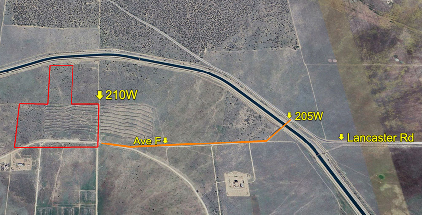
Directions to Property- |
Exit the Freeway 14 at Ave I. Go west on Ave I for 23 + miles as Ave I winds its way NW to Lancaster Rd (Ave E). Stay on Lancaster Rd as continues its way to the NW. At 205th West (there is a sign), turn left and go over the aqueduct. In the photo below follow the orange line for approximately 1/2 mile to the subject property.
|
|
|