| |
|||
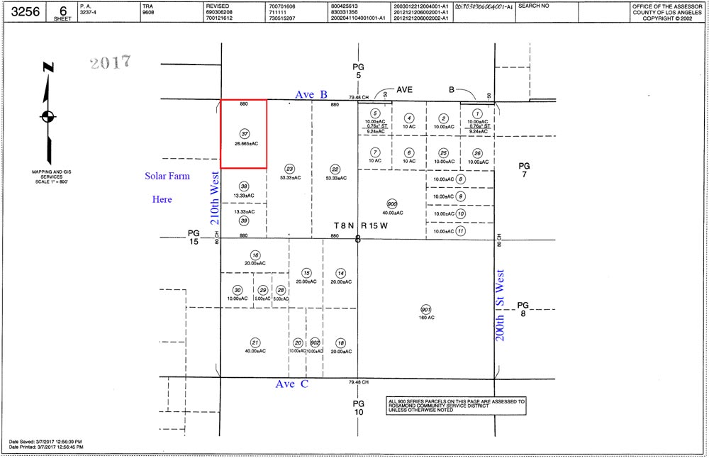
| 26.665
Acres, 210th St West & Ave B, Solar Territory |
|||
|
|
 |
||
 |
|||
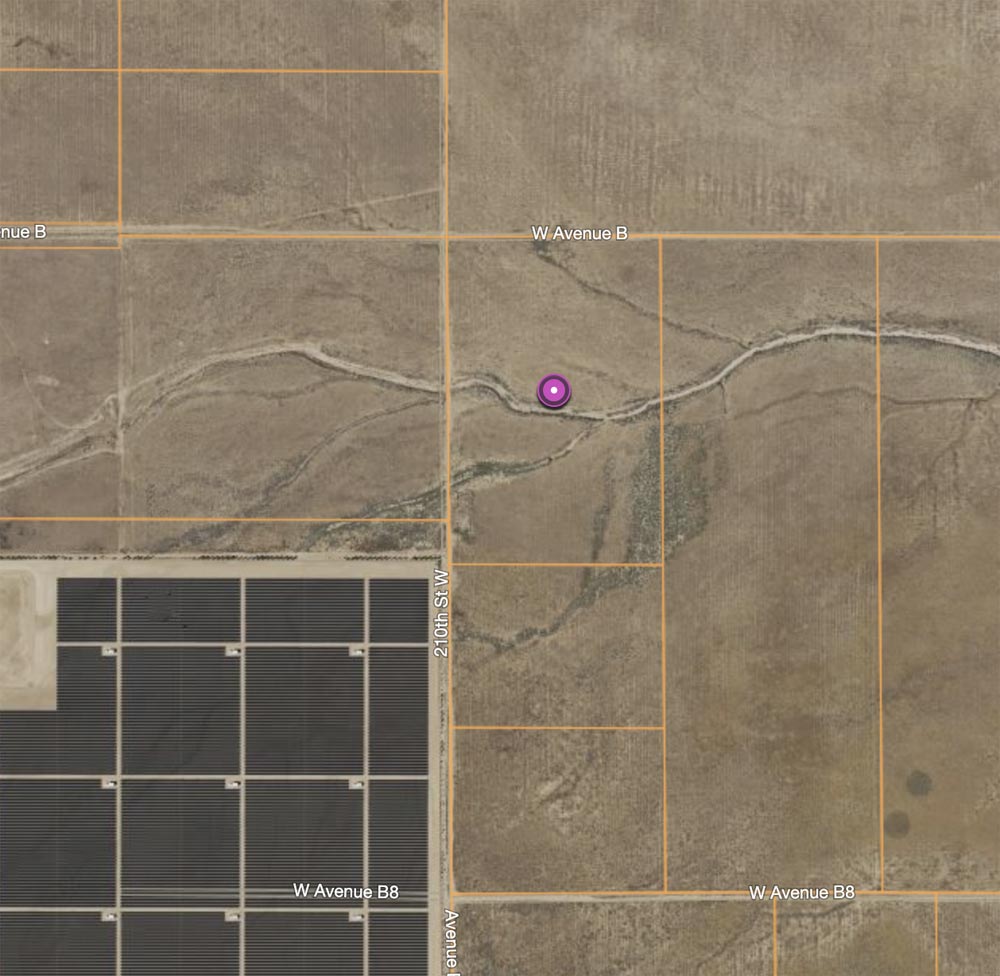
| Location- |
on 210th St West, at Ave B, SE corner | |
Area- |
NW of Lancaster | |
Acres- |
26.665 acres |
|
APN- |
3256-006-037 |
|
Zoning- |
A 2 2, R L 10 | |
Topography- |
flat & level | |
Dimensions- |
i880’ x 1,320’ . | |
Utilities- |
none to parcel | |
Price- |
$72,850 ($2,732 per acre) | |
Existing Notes- |
free & clear | |
Terms- |
all cash | |
Remarks- |
Flat 26+ rural acres located NW of Lancaster. Parcel
has easy access roads that lead right to the property at Ave B. Elec
is on Ave D, 1.75 miles to the south. Water source would be well water
(needed). Present zoning allows for heavy agriculture use and one home.
Area is unincorporated; the County of Los Angeles would have jurisdiction
if developed. Parcel has a dry wash through its mid section. Parcel
is a long term path of growth parcel. The General Plan calls for Ave
D (Hwy 138) to be widened to accommodate the eventual increased traffic
from the Tejon Ranch development, west at Interstate 5. Ave D (Hwy 38)
leads west to the Fwy 5 and east to the Fwy 14. at 3,000.
Highest
& Best use: land bank / hold for investment |
|
Safety and Cautions- |
Anyone inspecting, or walking on the property, off the road, should be aware that rattlesnakes and other desert wild life could be in the area. Be careful and use common sense! | |
Directions to Property- |
From
the AV Fwy 14, exit at Ave D and go west 18.75 miles to 210th St West,
at the Edison sub-station. 210th West has signage. Turn right (N) on
210W and go 1 mile to Ave C, a dirt road. Continue north on 210W for
1 mile. Stop. You are
now at Ave B and the NW corner of subject property. |
|